In early May of 2007, I set out on what, to this day, is the longest road trip I’ve ever done at one time. Not only was it the longest distance (over 7,300 miles in just 19 days) but it was also a ride I did on my own – just me and my 2006 Harley Davidson Night Train that is. (Damn, I miss that bike.)
My bike withstood some hard riding without a single glitch. Although, I had to get it serviced twice and I wore out the back tire (think exposed steel belt) but that was to be expected. I didn’t have any fancy GPS device so I printed out my instructions, step by step of approximately 500 miles per page, then put those in a gallon sized storage bag, then used high-tech duck tape to secure it to my gas tank. I just had to glance down and read quickly while driving. (*laughs) Not pretty but it worked!
Every stop along this trip, with the exception of San Diego, was someplace that I’d never been to. It was an amazing adventure. The google maps here aren’t 100% accurate but close enough to give you the general idea.


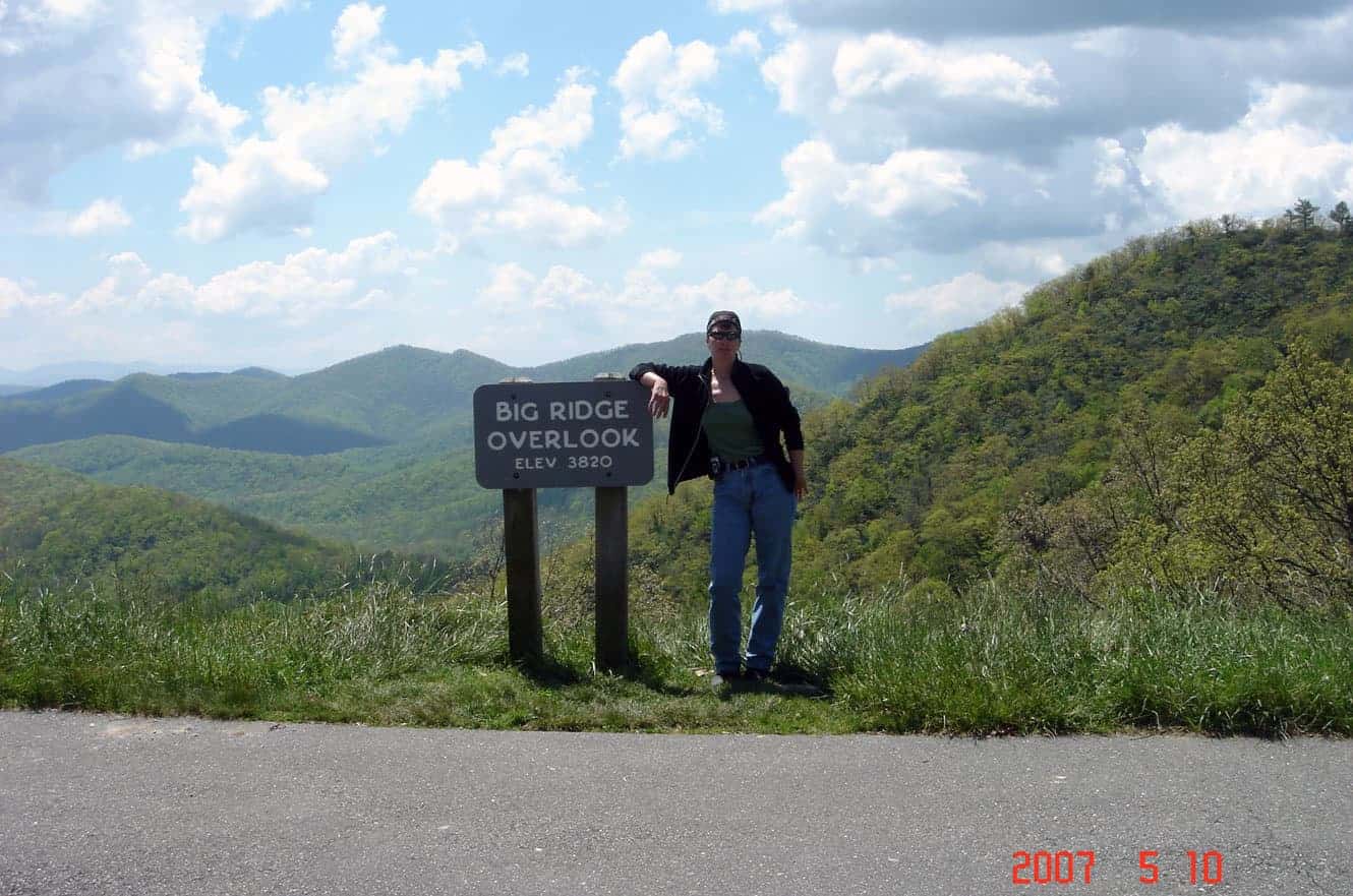


I left Wilmington North Carolina in the morning and headed for my first destination: The Blue Ridge Park Way. The parkway runs for 469 miles through Virginia and North Carolina but my ride was limited to the North Carolina section. There are stunning views of the Appalachian Highlands around every turn and friendly people willing to take your picture for you. 🙂

Unfortunately, not the best picture of Looking glass Rock. Named for the way its granite face reflects the sunlight – it’s a popular rock climbing destination.

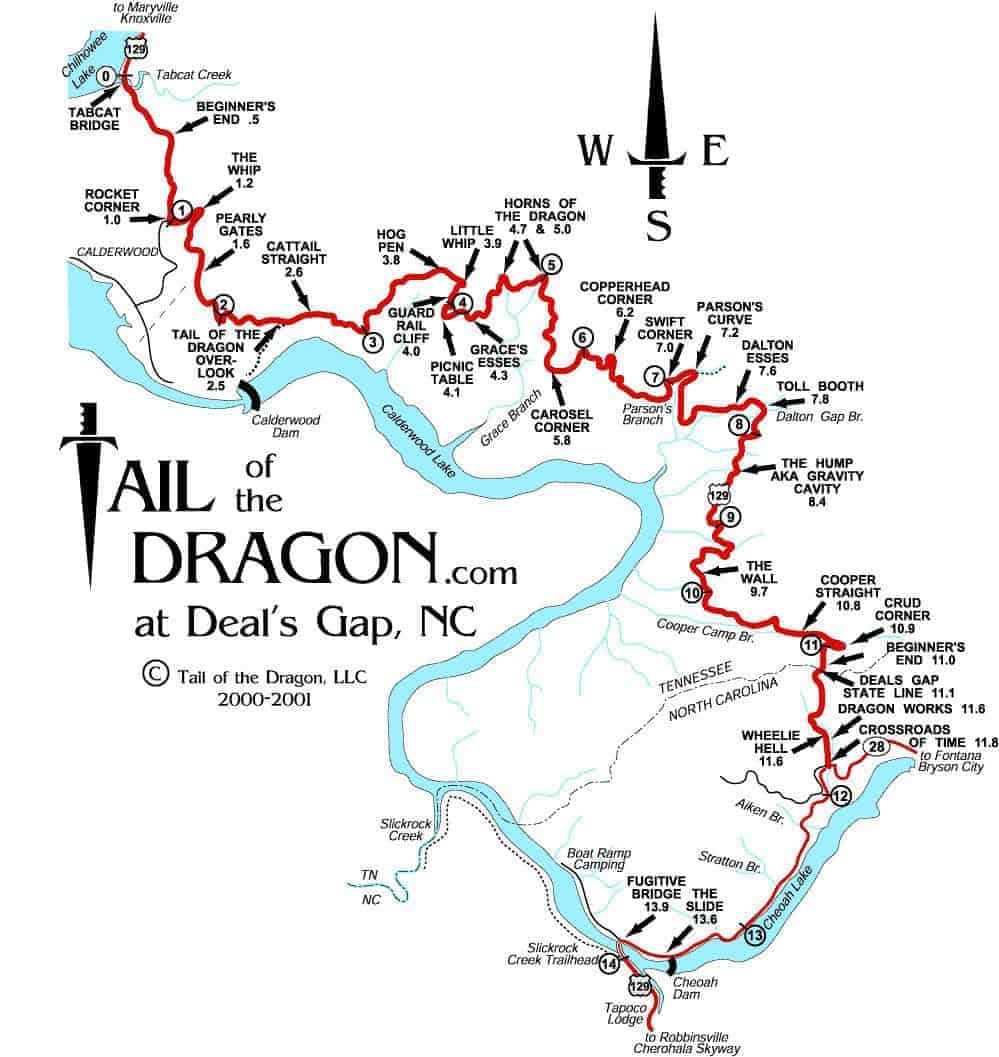

To this day I have no idea what the scenery was along the “Tail of the Dragon” ride in Deals Gap Tennessee. With 318 curves in 11 miles, I didn’t dare take my eyes off the white line… and trust me, it’s the white line you want to stay close to because the yellow line got crossed over far too often by oncoming traffic. There’s even a makeshift shrine to those “bitten by the Dragon” called the “Tree of Shame”. It’s a large tree with motorcycle and car parts strewn about its limbs from people who didn’t make it through the Dragon in one piece.
I continued on to Nashville, Tennessee to stop at the “Tattoo and Horror” Festival, which has been going on now for 14 years. Unfortunately, I have no idea what happened to the pictures from that part of my trip. You’ll just have to close your eyes and imagine.
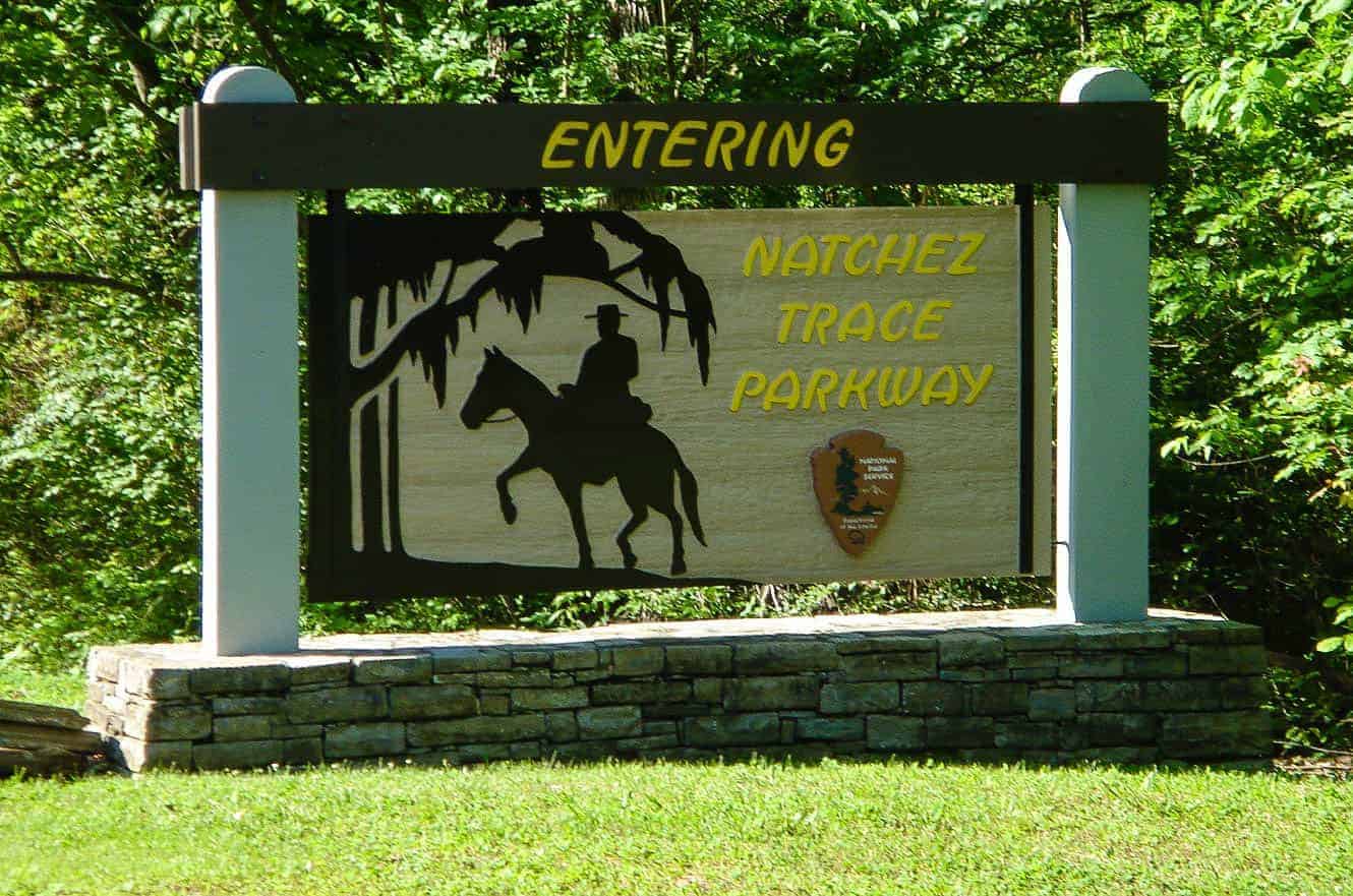
Leaving Nashville I entered the Natchez Trace Parkway, a 444 mile drive through trees. Lots of trees. To be honest, I think I fell asleep on the parkway because it was all trees, albeit pretty trees, and a strictly enforced 50 mph speed limit along most of the way. Once again I am picture-less in this area, but hey, I did get the sign!

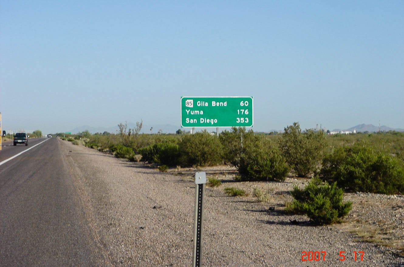
After spending a fun night in Natchez Mississippi, I flew through Texas to get to the Big Bend National Park in the southwest corner of the state. Growing up in New England, I’d never seen anything like this landscape before. The Rio Grande acts as the boundary between the US and Mexico and the park covers over 801,000 acres.

There are about 150 cougar sightings each year here, despite the fact that there are only 2 dozen cougars that live in the park. Pretty busy cougars, eh? The park also has deer, Mexican Black Bear, Javalina and over 450 species of birds. This is the Chisos Basin Road.


The Rio Grande River was a lot smaller here than I thought it would be. For some reason, I was expecting a massive river hundreds of feet in width. So much for assumptions.

As a self confessed Yankee, I’d had little contact with something called a “flash flood”, but that was SOON to change. *laughs
It was dusk and had been raining steadily by the time I left the west entrance of the park. Now, most people would slow down in the rain but not me. Nope. I like to go faster. The theory being: I’ll be wet and miserable for less time. So here I was speeding along and, just before I hit a curve, I see a red cone in the middle of the road. Now, I don’t pretend to be the brightest bulb in the box, so my only thought was; “Gee, I wonder what the cone is for?” And just as I finished that thought, I see water flowing over the road (little white caps of terror for a good 20-30′), and there’s one thing you NEVER do when the road is wet and you’re flying around a corner on 2 wheels: hit the breaks.
So, I did the only thing I could do, straighten out the bike and let go of the throttle… oh, and hold on for dear life. I must have hit that water doing about 40 mph. It’s a damn good thing that the combined weight of the bike, my gear, and me (I?) was over 800 lbs. The rooster tail must have been impressive from a distance – had there been anyone to see it. My rain gear just couldn’t keep up with the deluge. I had so much water in my boots that I squished when I got off the bike at my hotel later that night.
I’m sure that the people in the road emergency vehicle I met, coming from the opposite direction, thought I was loco. I just waved as I went by. La la la la la. Scary to say it, but that road was so desolate, if I’d gotten washed away, I may have not been found for weeks. *shiver


I made it to San Diego (Del Mar and Torrey Pines) without any further incidents. (Well, except for that downpour on the New Mexico/Arizona border and that slightly creepy truck driver who felt the need to tell me, while I was getting gas, that his girlfriend didn’t mind if he had other women – CACK – but that’s a story for another day.)

My first stop after I left San Diego was a motorcycle rally in Santa Maria, California. I didn’t stay long. I’d originally planned to head further north along the Pacific Coast Highway but I decided to head to Death Valley instead.


Even mid May, the temperature in Death Valley was 114°F. It literally sucked the moisture from your body driving through it on a bike. I was so overheated by the time I made it out that I stopped at the first gas station I could find. 45 minutes and 3 bottles of water later, I was good to go.

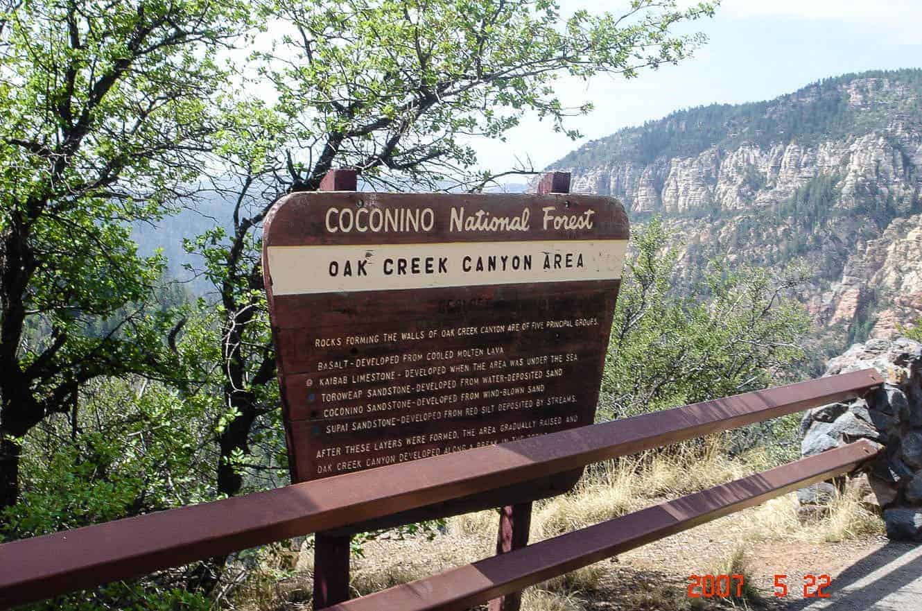
The Coconino National Forest is a 1.856-million acre United States National Forest located near Flagstaff, Arizona. I wish I’d spent more time here but it was just a quick stop on my way to the Grand Canyon.


It was an overcast and hazy day but that didn’t deter from the magnificence of the Grand Canyon National Park. I stayed in Flagstaff 2 nights so I could spend a full day up here. I found a hotel in town that was within a short walking distance of a bar. I closed it down both nights I was there. *laughs


It was 36°F when I left Flagstaff: Torrential rain, unbearable heat, and freezing cold – all in one trip. A small bag I kept on the back of my bike was lost (stolen) in Bakersfield California and in it: my rain gear, passport, and warmer outerwear. I broke down and purchased a jacket (on sale) but got stubborn on getting more rain gear.


This is the world’s best preserved meteorite impact site. Just minutes from I40, I figured it was a must see. It’s almost 1 mile across and over 550′ deep. Pretty impressive even if it’s a bit of a tourist trap.
Somewhere in Arkansas I got waylaid getting a bald back tire replaced at one of the Harley dealerships. Nice guys running the place. I wish I could remember which one it was.

The Atlanta Motor Speedway (Georgia) was my final destination before heading home. … and the picture above is of its first annual motorcycle rally… I can’t help but wonder if it was the last. There were more vendors than participants. I had planned on staying the night there but it seemed like a silly idea once I saw the place was pretty empty. I stayed long enough to have a few beers – most provided free by a bored vendor. *laughs


2 thoughts on “My longest solo motorcycle ride – NC to CA”
I am very impressed with your adventure! I want to take the same trip on my bike from Calif. to Raleigh to visit relatives. Can you offer any tips for me? Did you have any problems with crime or just general idiots along the way?
Thanks,
Mike
Well Mike,
I hope you’re not a spammer! As far as my trip… I didn’t run into much crime, although I did have a bag stolen off my bike when I stopped for lunch in Bakersfield, CA. As to “general idiots”, I found most people extremely nice and helpful with the occasional creepy truck driver thrown in. I’ve a feeling that you’ll get less “creepy truck drivers” than I did. lol
I don’t have many tips other than to stop in small local places and talk to the locals. I learned a lot from doing that. … and watch out for flash floods – driving through one of those is pretty scary. 🙂